The Himalaya, a name translating to "Abode of Snow," is the world's highest and youngest mountain range, spanning approximately 2,400 kilometers in an arc across Asia and serving as a fundamental geographic, climatic, and cultural feature of the region. This colossal mountain system separates the plains of the Indian subcontinent from the Tibetan Plateau, influencing global weather patterns and hydrology through its immense elevation.
Geological Formation: The Collision of Continents
The Himalayas are a quintessential example of continent-continent convergence in plate tectonics, representing one of the most dramatic and ongoing mountain-building events, or orogenies, on Earth.
Pre-Collision History (The Tethys Sea)
* Pangaea Breakup (c. 200 million years ago - Ma): The supercontinent Pangaea began to break apart. The Indian Plate, a fragment of the southern supercontinent Gondwana, began a rapid, northward drift, moving at an unusually high speed (up to 15-20 cm/year).
* Tethys Ocean: Before the collision, a vast, ancient ocean known as the Tethys Sea separated the Indian Plate from the Eurasian Plate (which contained most of Asia). Sediments accumulated on the floor of this geosyncline over millions of years.
The Collision and Uplift (Orogenesis)
* Initial Contact (c. 50-40 Ma): The Indian Plate finally collided with the Eurasian Plate. Because both landmasses are continental crust (low density/high buoyancy), neither could be easily subducted deep into the mantle.
* Crustal Shortening and Thickening: The massive compressional forces caused the Earth’s crust to shorten, fold, and thrust repeatedly, scraping the Tethys marine sediments (now visible as sedimentary rocks and fossils high in the mountains) and uplifting both the Himalayas to the south and the vast Tibetan Plateau to the north.
* Major Thrusts: The uplift occurred in successive phases along major fault lines:
* Main Central Thrust (MCT): Marked the initial and major uplift, raising the Greater Himalayas (Himadri) approximately 30-35 Ma.
* Main Boundary Thrust (MBT) / Main Boundary Fault (MBF): Led to the rise of the Lesser Himalayas (Himachal) approximately 15-20 Ma.
* Main Frontal Thrust (MFT): Responsible for the rise of the youngest, southernmost foothills, the Shiwaliks, in the most recent phases.
* Ongoing Uplift: The process continues today. The Indian Plate is still moving northward beneath the Eurasian Plate at a rate of about 4-5 cm per year, causing the Himalayas to rise by over 1 cm annually. Erosion, however, acts as a counter-force, preventing the mountains from growing indefinitely higher.
The Himalaya Elevation and Geological Timeline (Conceptual Graph Description)
Since a visual image is prohibited, the following describes a conceptual graph illustrating the relationship between time, tectonic movement, and elevation along a north-to-south cross-section.
| Conceptual Graph Description: Himalayan Cross-Section and Timeline |
|---|
| X-Axis (Horizontal): Geographic Distance (South to North), starting at the Indo-Gangetic Plain and extending to the Tibetan Plateau. |
| Y-Axis (Vertical): Elevation (Altitude in Meters), ranging from 0 to over 9,000 meters. |
| Data Curves/Points (Elevation Profile): A line showing the topography, moving from south to north: |
| 1. Indo-Gangetic Plain (South): Starts at low elevation (0-300 m), flat topography. |
| 2. Shiwalik Range (Outer Himalaya): A rapid, sudden increase in elevation, peaking at 900-1,500 m. This range appears as the first, sharp, but lowest rise. |
| 3. Lesser Himalaya (Himachal): A steep, rugged rise after the Shiwaliks, with elevations reaching 3,700-4,500 m. The profile shows a wider, more dissected mountain block than the Shiwaliks. |
| 4. Great Himalaya (Himadri): The profile line dramatically spikes to its absolute highest points, showcasing the world's tallest peaks, with an average elevation over 6,100 m and individual peaks reaching nearly 8,850 m (Mount Everest). This is the highest and most continuous ridge on the profile. |
| 5. Trans-Himalaya/Tibetan Plateau (North): The elevation drops slightly from the Great Himalayan peaks but remains consistently extremely high, leveling out into the vast, arid Tibetan Plateau, with average elevations of 4,000–5,000 m. |
| Annotations (Geological Timeline): Labels placed near the fault lines on the graph to indicate major uplift phases. |
| * 50 Ma: Label on the southern edge of the Tibetan Plateau indicating the start of the India-Asia collision. |
| * 30-35 Ma (MCT): Label at the Great Himalaya peak, marking the uplift phase of the core. |
| * 15-20 Ma (MBT): Label at the Lesser Himalaya peak, marking its uplift phase. |
| * <5 Ma (MFT): Label at the Shiwalik Range, marking the most recent phase. |
| Conclusion from Graph: The resulting profile is asymmetrical. The southern slopes (facing the Indo-Gangetic Plain) are very steep and compressed, reflecting the intense northward thrust of the Indian Plate, while the northern slopes (facing the Tibetan Plateau) are generally gentler. |
Physiographic Divisions (North to South)
The Himalayas are conventionally divided into four parallel, longitudinal belts, each with distinct geological and topographical characteristics:
1. The Trans-Himalaya (Tibetan Himalaya)
* Location: Northernmost range, largely in Tibet, bordering the Great Himalayas.
* Features: Contains the Zanskar, Ladakh, Kailas, and Karakoram ranges (though the Karakoram is often considered a separate system). It is an arid, cold, high-altitude desert zone.
* Geology: Primarily composed of sedimentary rocks from the Tethys Sea, often containing marine fossils.
2. The Greater Himalaya (Himadri / Inner Himalaya)
* Location: The core, central range, and the most continuous range.
* Features: Home to the world's highest peaks, including Mount Everest (8,848.86 m), Kanchenjunga (8,586 m), Lhotse (8,516 m), and Makalu (8,485 m).
* Elevation: Average elevation is approximately 6,100 meters.
* Geology: Composed primarily of crystalline and metamorphic rocks (granite, gneiss, schists). It is permanently snow-bound, giving rise to numerous large glaciers (like Gangotri and Siachen) that feed major rivers.
3. The Lesser Himalaya (Himachal / Middle Himalaya)
* Location: South of the Greater Himalayas, separated by the Main Central Thrust (MCT).
* Elevation: Average elevation ranges between 3,700 and 4,500 meters.
* Features: A more rugged and dissected system. Contains important ranges like the Pir Panjal (the longest range), Dhaola Dhar, and Mahabharat Lekh. It is renowned for its hill stations (e.g., Shimla, Mussoorie, Darjeeling) located on gentle slopes.
* Valleys: Known for beautiful, longitudinal valleys like the Kashmir Valley and Kathmandu Valley.
4. The Outer Himalaya (Shiwalik / Sub-Himalaya)
* Location: Southernmost and youngest range, bordering the Indo-Gangetic Plains.
* Elevation: Average elevation ranges between 900 and 1,500 meters.
* Geology: Formed by the unconsolidated river sediments and detritus washed down from the higher ranges.
* Duns/Doons: Between the Shiwaliks and the Lesser Himalayas lie flat-floored, longitudinal valleys known as Duns (e.g., Dehra Dun).
Climatic and Ecological Significance
The Himalayas act as a massive, impenetrable climatic barrier, profoundly affecting the weather of the Indian subcontinent and Central Asia.
Monsoon Barrier
* Impact on South Asia: The mountains block the moisture-laden summer Southwest Monsoon winds from the Bay of Bengal and the Arabian Sea, forcing them to shed their rain on the southern slopes, resulting in exceptionally high rainfall in regions like the Eastern Himalayas (e.g., Meghalaya). This is vital for agriculture in the Indo-Gangetic Plain.
* Impact on Central Asia: They prevent the extreme cold, dry katabatic winds from Siberia and Central Asia from entering the Indian subcontinent during winter, keeping the plains relatively warm.
Ecological Zonation (Altitude-Driven)
The sharp change in elevation over a short distance leads to distinct vertical ecological zones, from tropical to polar climates:
| Ecological Zone | Elevation Range | Characteristic Vegetation |
|---|---|---|
| Tropical/Subtropical | Up to \sim1,500 m | Sal forests, sub-tropical broadleaf forests, high humidity. |
| Temperate | \sim1,500 m to 3,500 m | Temperate forests, oaks, maples, and conifers (pine, deodar, fir, spruce). Home to much of the region's biodiversity. |
| Alpine | \sim3,500 m to 4,500 m | Alpine Meadows (grasses, shrubs, rhododendrons). |
| Nival/Perpetual Snow | Above \sim4,500 m | Permanent Ice and Snow (glaciers and barren rock). The zone above the tree line (timberline). |
Hydrological Importance and Rivers
The Himalayas are known as the "Third Pole" due to the massive volume of ice and snow stored in their glaciers, second only to the polar regions. They are the source of some of Asia's greatest perennial river systems:
* Indus River System: Includes the Indus, Jhelum, Chenab, Ravi, Beas, and Satluj, mainly originating in the Western Himalayas and Trans-Himalayas.
* Ganges (Ganga) River System: Fed by numerous tributaries originating from the Gangotri, Yamunotri, and other glaciers in the Central Himalayas.
* Brahmaputra (Tsangpo) River System: Originates in the Tibetan Plateau near Mount Kailash (Trans-Himalaya) and flows eastward before turning south into India and Bangladesh.
These rivers, known as antecedent rivers because they predate and cut across the rising mountain ranges, have carved massive gorges, illustrating the rapid uplift of the system. The Himalayan rivers are essential for the water security, irrigation, and power generation for billions of people in South Asia.
The Himalaya: A Cultural and Political Divide
The immense scale of the Himalayas has historically made them a significant barrier, influencing cultural separation, migration patterns, and political boundaries.
* Countries: The range spans across five nations: India, Nepal, Bhutan, China (Tibet), and Pakistan.
* Biodiversity Hotspot: Due to its immense altitudinal and climatic variation, the region is recognized as a global biodiversity hotspot, hosting numerous endemic species of flora and fauna (e.g., Snow Leopard, Red Panda, musk deer).
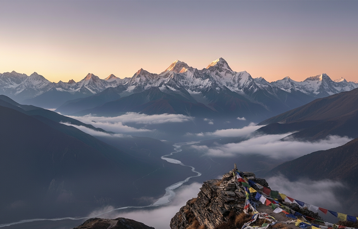
* Spiritual Significance: Many peaks are considered sacred in Hinduism, Buddhism, and Bon traditions, notably Mount Kailash and Mount Kanchenjunga. The region is dotted with major pilgrimage sites (e.g., Amarnath, Kedarnath, Muktinath).
In summary, the Himalaya is not merely a mountain range but an active, dynamic, geologically young system born from a continental collision that continues to reshape the planet. It is a critical nexus of geography, climate, ecology, and human civilization, defining the physical and cultural landscape of South and Central Asia.