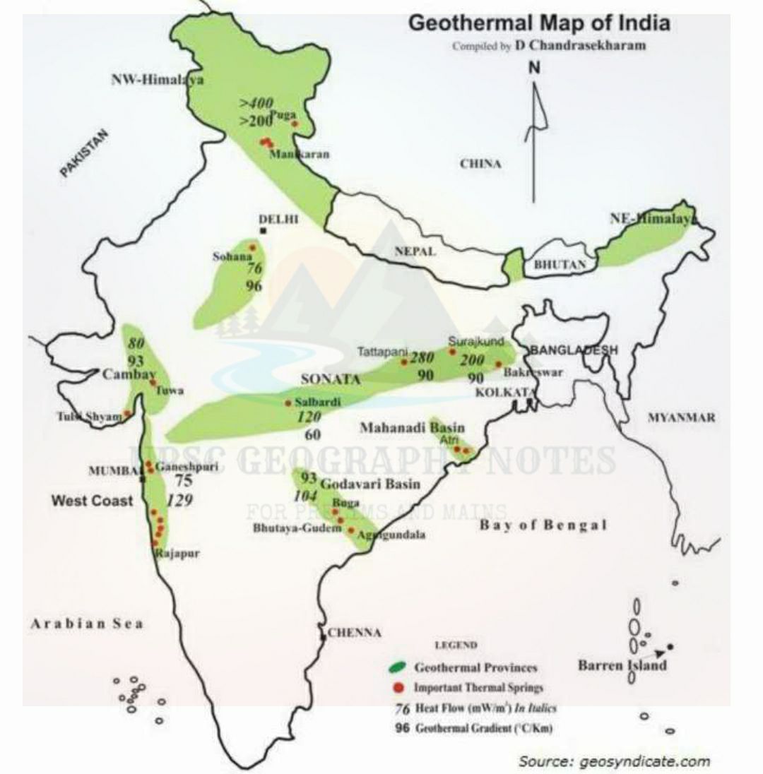
◇ There are vast possibilities of developing and exploiting geothermal energy in india. About 340 hot spring localities have been identified, many of them have temperature nearing boiling point. ◇ Assessment of geothermal energy potential of selected sites in Jammu and Kashmir, HP, UK,kharkhand and chhattisgarh has been undertaken. ◇ A five KW geothermal pilot power plants has been commissioned at Manikaran in Kullu district of HP. A potential of 4-5 mW geo-thermal power ...Read More
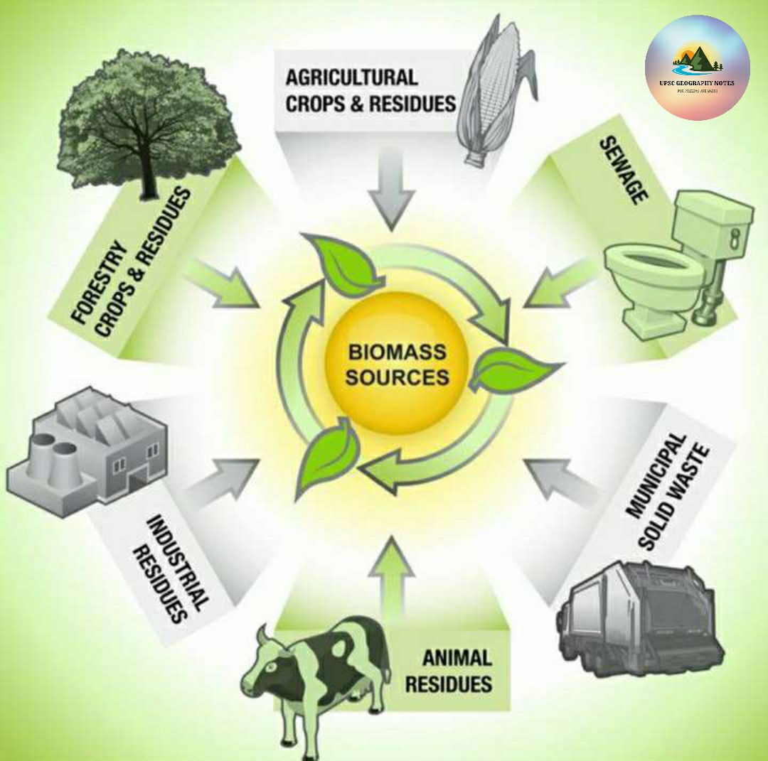
◇ Bio energy is a clean source of energy which improves sanitation, hygiene and the living style of the rural population. ◇ This technique is based on the decomposition of organic matter in absence of air to produce gas. ◇ India has a capacity to produce bio-gas to the extent of 25,000 million cubic m. the left over digested slurry serves as manure. This can meet 50% of rural domestic fuel instruments. ◇ UP has the highest potential in bio-gas, followed by MP...Read More
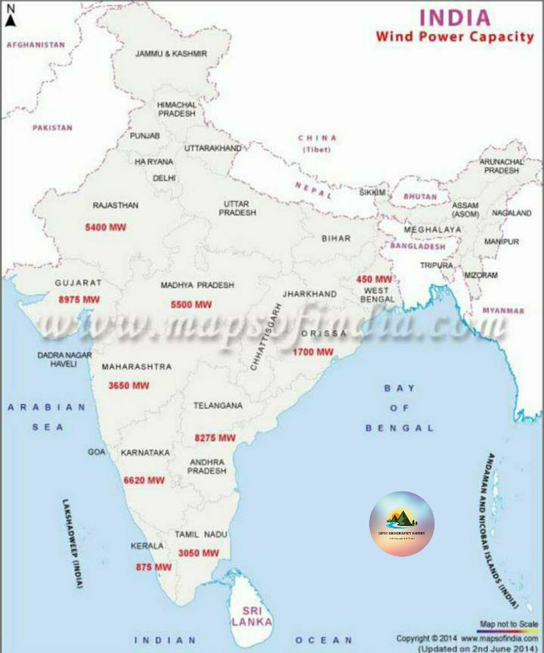
◇ Wind is another important source of non-conventional energy. ◇ once the generation starts, cost-free power is available for about 20 years because there is no recurring cost on fuel. ◇ Since 1985, the MNES has carried out an extensive wind monitoring and mapping programme to identify better sites and to assess the resource potential. ◇ Coastal areas in Gujarat, TN, AP, Odisha and WB as well as vast areas of MH, MP and Rajasthan are in a much better position w...Read More
◇ Research and development in the field of solar thermal energy is continuously being pursued in the field of solar thermal energy is continuously being pursued in the country for about four decades. ◇ As a result several products have been developed indigenously. ◇ It has five components – Solar thermal extension programme, Solar cooker programme, Solar buildings programme, Research and development (R&D) programme and Aditya solar shops. ...Read More
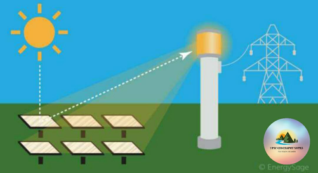
◇ Sun is ultimate source of all energy on the earth. India, being a tropical country, is well endowed with plenty of solar energy. ◇ India receives nearly 3,000 hours of sunshine every year which is equivalent to over 5000 trillion kWh per year. ◇ The daily average of solar energy incident over india varies from 4 to 7 kWh/m square depending upon the location. ◇ Although solar energy can be gainfully used in any part of the country except some higher areas in...Read More

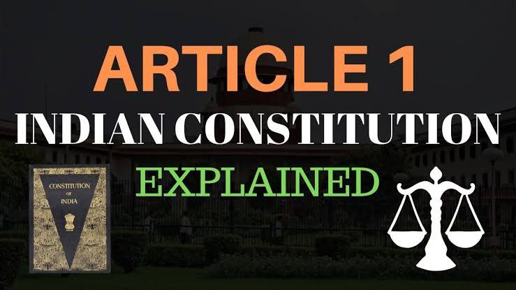
???? ARTICLE 1 ????️ According to Article 1, the territory of India can be classified into three categories :- 1. Territories of the states. 2. Union territories. 3. Territories that may be acquired by the Government of India at any time. ????️ The names of states and union territories and their territorial extent are mentioned in the first schedule of the Constitution. ...Read More
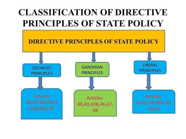
◇ According to Dr. B.R. Ambedkar, the Directive Principles of State Policy is a ‘novel feature’ of the Indian Constitution. ◇ They are enumerated in Part IV of the Constitution. They can be classified into three broad cat-egories–socialistic, Gandhian and liberalintellectual. ◇ The Directive Principles are meant for promoting the ideal of social and economic democracy. They seek to establish a ‘welfare state’ in India ...Read More
◇ The critics stated that the Indian Constitution is too bulky and too detailed and contains some unnecessary elements. ◇ Sir Ivor Jennings, a British Constitutionalist, observed that the provisions borrowed were not always well-selected and that the constitution, generally speaking, was too long and complicated. ...Read More

◇ The critics opined that the Indian Constitution contains nothing new and original. They described it as a ‘borrowed Constitution’ or a ‘bag of borrowings’ or a ‘hotch-potch Constitution’ or a ‘patchwork’ of several documents of the world constitutions. ◇ However, this criticism is unfair and illogical. This is because, the framers of the Constitution made necessary modifications in the features borrowed from other constitutions for their suitability to the Indian...Read More

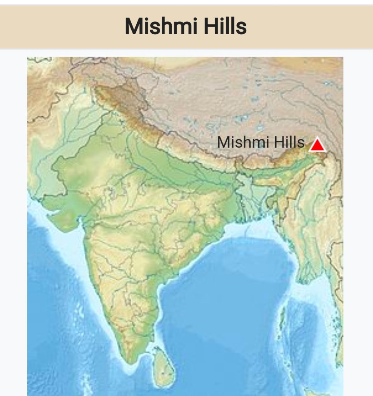
▪️The Mishmi Hills are located at the northeastern tip of India, in northeastern Arunachal Pradesh ▪️This hilly area is characterised by steeply sloping landform, sub-tropical evergreen forest and high rainfall. ▪️There are about 6000 plant species, 100 mammal species and about 700 bird species. There are also a large number of butterflies and other insects. ...Read More