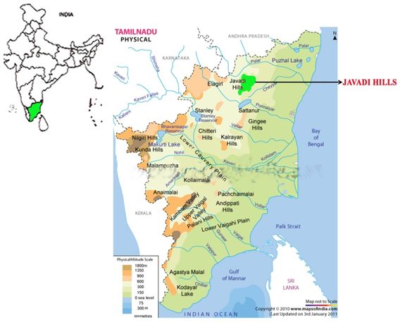
▪️The Javadhi Hills (also Jawadhi, Jawadhu Hills) are an extension of the Eastern Ghats spread across parts of Vellore and Tiruvannamalai districts in the northern part of the state of Tamil Nadu in southeastern India. ▪️ During the British colonisation of India, the Javadhu Hills appeared occasionally in government gazetteers and manuals, ethnographies, and travelers' accounts. Henry le Fanu, writing in 1883, admired the beauty of the Jawadhi hills. ▪️...Read More
◇ It increased the number of additional (non-official) members in the Central and provincial legislative councils, but maintained the official majority in them. ◇ It increased the functions of legislative councils and gave them the power of discussing the budget and addressing questions to the executive. ◇ It provided for the nomination of some non-official members of the :- • Central Legislative Council by the viceroy on the recommendation of the provincial le...Read More
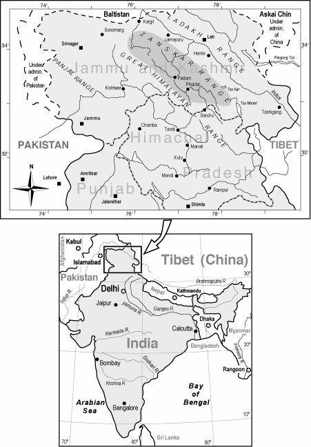
▪️ The Zaskar Range or Zanskar Range is a mountain range in the Indian regions of Jammu and Kashmir and Ladakh, that separates Zanskar from Ladakh. ▪️Zanskar Range is part of the Tethys Himalaya ▪️The average height of the Zanskar Range is about 6,000 m (19,700 ft). ▪️ Kamet Peak (25,446 feet) in chamoli, uttarakhand is the highest point, and the most important passes are Shipki, Lipu Lekh. ...Read More
▪️ Malwa Plateau, plateau region in north-central India ▪️ Of volcanic origin, the plateau comprises central Madhya Pradesh state and southeastern Rajasthan state. ▪️ The name Malwa is derived from the Sanskrit malav (part of the abode of Laksmi [goddess of wealth]). ▪️ The plateau was ruled successively by the Maurya, Gupta, and Paramara dynasties ▪️The western part of the region is drained by the Mahi River, the middle section...Read More
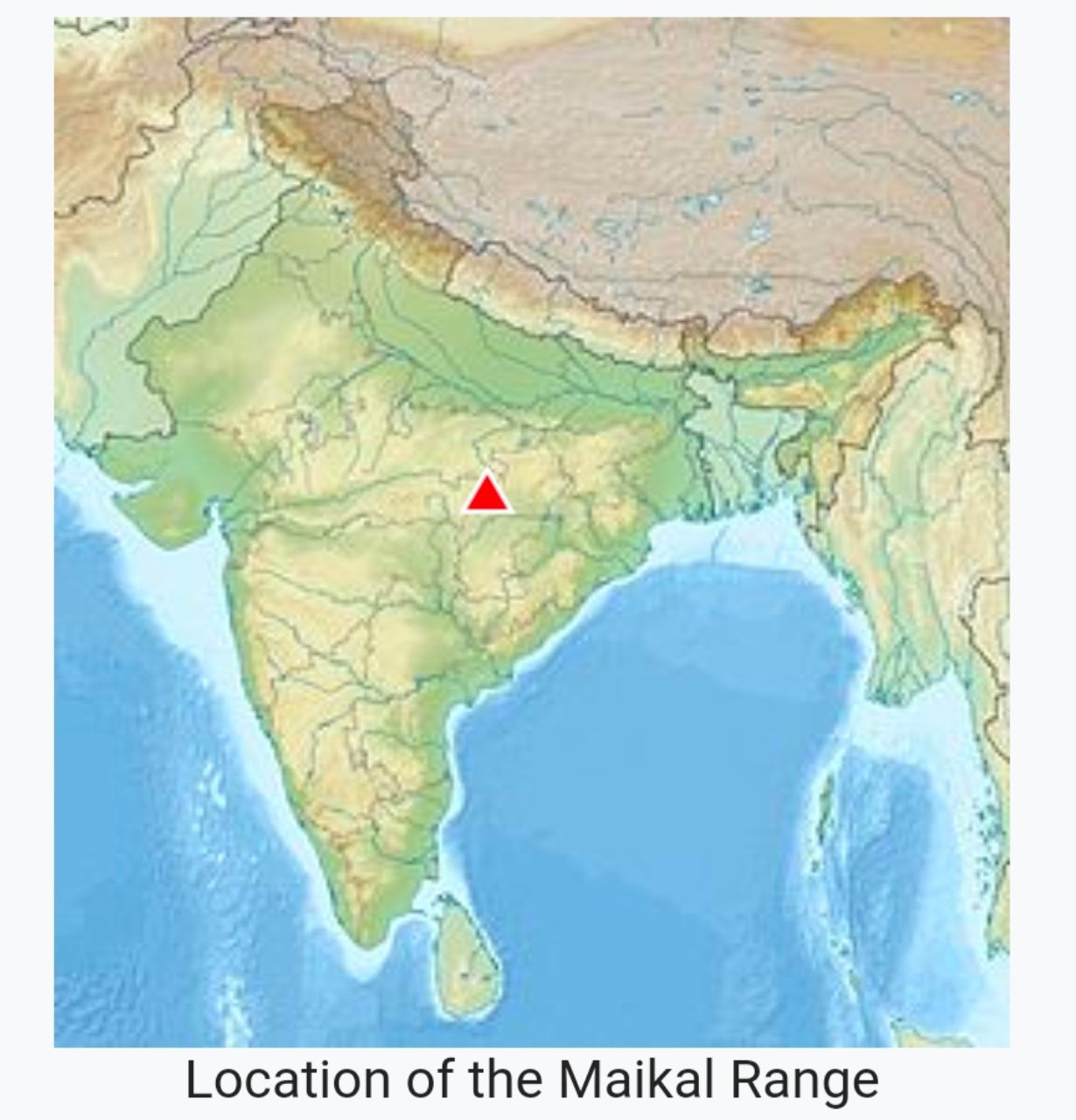
▪️The Maikal Hills are range of hills in the state of Chhattisgarh India. ▪️The Maikal Hills are an eastern part of the Satpuras in Kawardha District of Chhattisgarh ▪️ This densely forested and thinly populated range gives rise to several streams and rivers including the tributaries of Narmada and Wainganga rivers. ▪️ The hills are inhabited by two tribal peoples, the Baigas and the Gonds ▪️The hills are known to contain ba...Read More
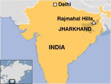
▪️Rajmahal Hills are located in the Santhal Pargana division of Jharkhand, India ▪️its hills are today inhabited by the Sauria Paharia people whilst its valleys are dominated by the Santhal people. ▪️The Rajmahal hills are named after the town of Rajmahal ▪️The River Ganges wanders around the hills changing the direction of flow from east to south. ▪️ Francis Buchanan-Hamilton travelled through the Rajmahal hills in the early 19...Read More
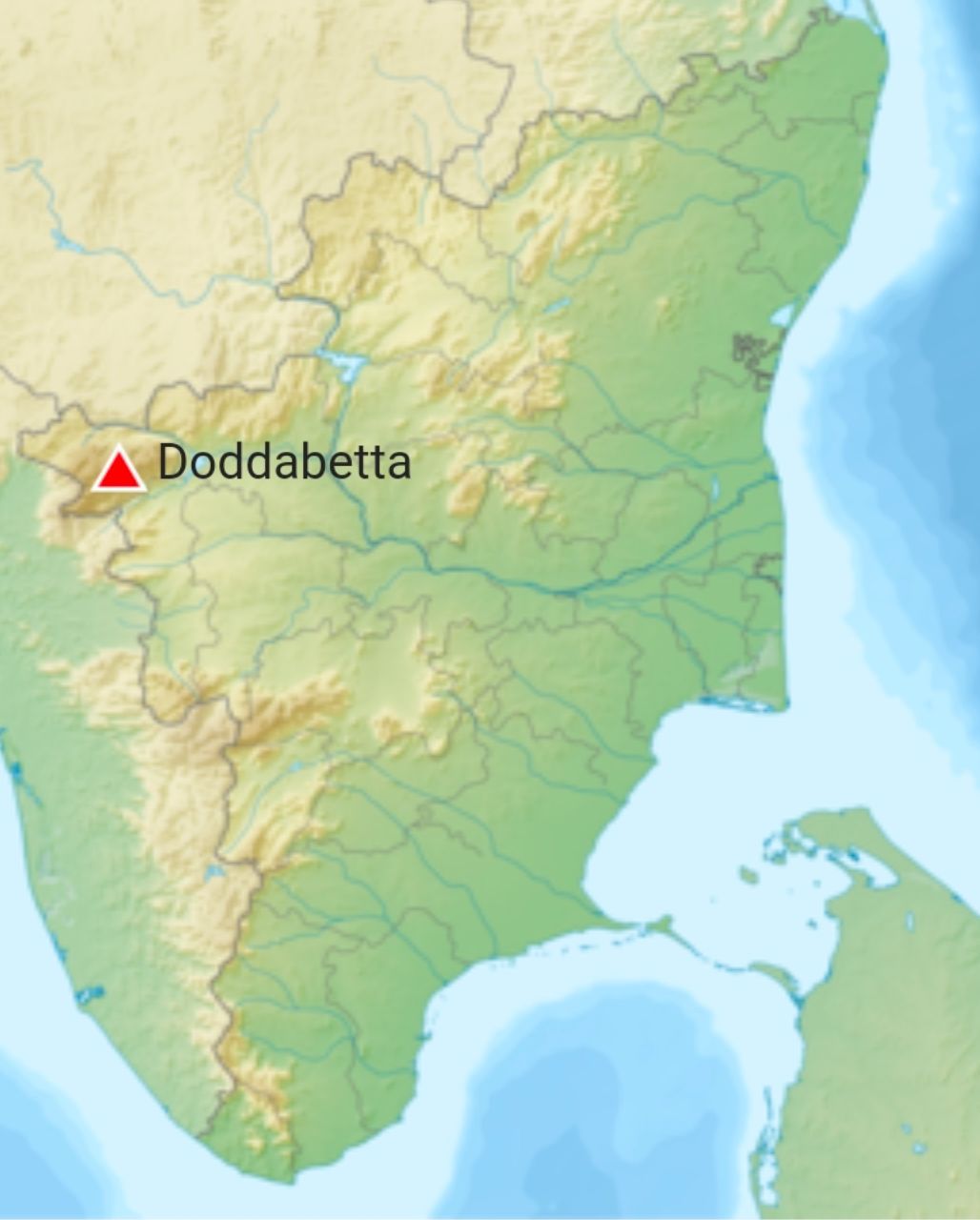
▪️Doddabetta is the highest mountain in the Nilgiri Mountains at 2,637 metres (8,652 feet) ▪️ It is the fourth highest peak in South India next to Anamudi, Mannamalai and Meesapulimala. ▪️ Location : Udagamandalam, Nilgiri District, Tamilnadu ▪️ Parent range : Nilgiri Hills ▪️The area surrounding Doddabetta is mostly forested. Sholas cover the hollows of its slopes ...Read More
▪️Also known as Churia Hills ▪️In some Sanskrit texts, the region is called Manak Parbat. ▪️Sivalik region is home to the Soanian archaeological culture ▪️They have many subranges and extend west from Arunachal Pradesh through Bhutan to West Bengal, and further westward through Nepal (here known as Churia Hills) and Uttarakhand, continuing into Himachal Pradesh and Kashmir. ▪️People of the Lepcha tribe inhabit the Sikki...Read More
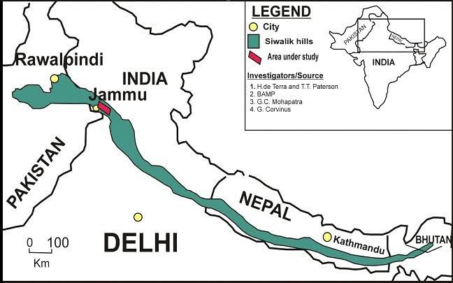
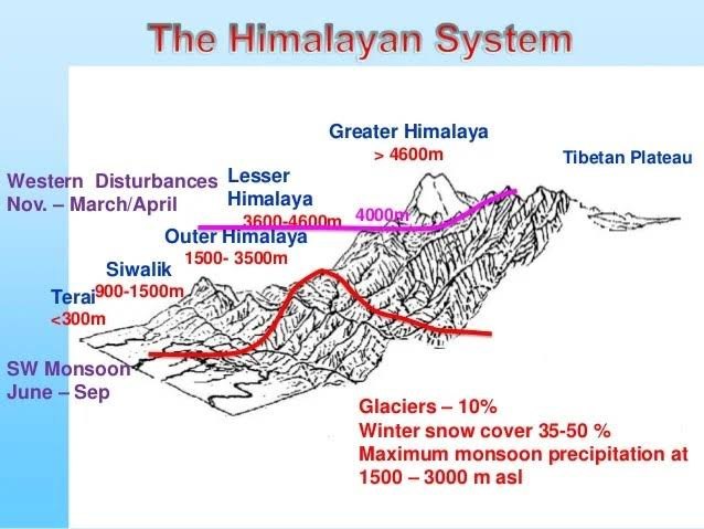
◇ Lies between Great plains and Lesser himalayas. ◇ Altitude varies between 600 - 1500m. ◇ Runs for distance of 2400km from Potwar plateau (west) to Brahmaputra valley (east). ◇ Souther slope steep while Northern slope Gentle. ◇ Slopes are highly dissected by seasonal steams called Chaos. □ FORMATION Shiwaliks are consolidated sands, gravels, conglomerate deposits which brought by Rivers flowing from Higher ranges. □ DI...Read More
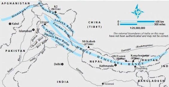
◇ Also called - Lower Himalayas. ◇ Lies between shiwaliks in south and Greater himalayas in North. ◇ 60 - 80km wide. ◇ 2400 km length. ◇ Southern slopes - steep and bare and Northern slopes - Gentle and forest covered. □ IMPORTANT RANGES ◇ Pir panjal range - J & K. ◇ Dhaola dhar range - HP. ◇ Mussorie range and Nag tibba range - UK. ◇ Mahabharat range - Nepal. ...Read More