ý§∏ý•çý§•ý§æý§™ý§®ý§æ ý§îý§∞ ý§≠ý•Çý§óý•ãý§≤ | ý§µý§øý§∂ý•áý§∑ý§§ý§æ | ý§µý§øý§µý§∞ý§£ | |---|---| | ý§∏ý•çý§•ý§æý§™ý§®ý§æ ý§µý§∞ý•çý§∑ | 1 ý§®ý§µý§Çý§¨ý§∞, 2000 (ý§Æý§ßý•çý§Ø ý§™ý•çý§∞ý§¶ý•áý§∂ ý§∏ý•á ý§Öý§≤ý§ó ý§ïý§∞ý§ïý•á ý§≠ý§æý§∞ý§§ý•Äý§Ø ý§∏ý§Çý§ò ý§ïý•á 26ý§µý•áý§Ç ý§∞ý§æý§úý•çý§Ø ý§ïý•á ý§∞ý•Çý§™ ý§Æý•áý§Ç ý§∏ý•çý§•ý§æý§™ý§øý§§ ý§ïý§øý§Øý§æ ý§óý§Øý§æ)ý•§ | | ý§∞ý§æý§úý§ßý§æý§®ý•Ä | ý§∞ý§æý§Øý§™ý•Åý§∞ | | ý§∏ý•Äý§Æý§æý§èý§Å | ý§∞ý§æý§úý•çý§Ø ý§®ý§øý§Æý•çý§®ý§≤ý§øý§ñý§øý§§ ý§∞ý§æý§úý•...Read More

Establishment and Geography | Feature | Details | |---|---| | Establishment Year | November 1, 2000 (Carved out of Madhya Pradesh as the 26th State of the Union). | | Capital | Raipur | | Borders | The state is bordered by: | | ¬Ý| North: Uttar Pradesh | | ¬Ý| Northeast: Jharkhand | | ¬Ý| East: Odisha | | ¬Ý| South: Andhra Pradesh and Telangana | | ¬Ý| West: Maharashtra and Madhya Pradesh | | Area | 135,194 \text{ sq km} (Ninth largest state in India by area). | | Nickname | "Rice Bo...Read More
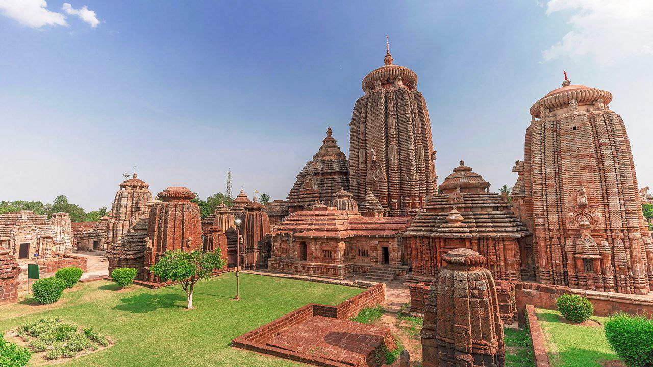
ý§Æý§ßý•çý§Ø ý§™ý•çý§∞ý§¶ý•áý§∂ ý§ïý§æ ý§∏ý§æý§Æý§æý§®ý•çý§Ø ý§Öý§µý§≤ý•ãý§ïý§® | ý§∂ý•çý§∞ý•áý§£ý•Ä | ý§µý§øý§µý§∞ý§£ | |---|---| | ý§∏ý•çý§•ý§æý§™ý§®ý§æ ý§µý§∞ý•çý§∑ | 1 ý§®ý§µý§Çý§¨ý§∞ 1956, ý§∞ý§æý§úý•çý§Ø ý§™ý•Åý§®ý§∞ý•çý§óý§Ýý§® ý§Öý§ßý§øý§®ý§øý§Øý§Æ ý§ïý•á ý§§ý§πý§§ý•§ (1 ý§®ý§µý§Çý§¨ý§∞ 2000 ý§ïý•ã ý§áý§∏ý§ïý§æ ý§™ý•Åý§®ý§∞ý•çý§óý§Ýý§® ý§ïý§øý§Øý§æ ý§óý§Øý§æ ý§•ý§æ, ý§úý§¨ ý§áý§∏ý§ïý•á ý§¶ý§ïý•çý§∑ý§øý§£-ý§™ý•Çý§∞ý•çý§µý•Ä ý§ïý•çý§∑ý•áý§§ý•çý§∞ ý§∏ý•á ý§õý§§ý•çý§§ý•Äý§∏ý§óý§¢ý§º ý§∞ý§...Read More

General Overview of Madhya Pradesh | Category | Detail | |---|---| | Establishment Year | November 1, 1956, under the States Reorganisation Act. (It was later reorganised on November 1, 2000, when the state of Chhattisgarh was carved out of its southeastern region.) | | Borders | The state is landlocked and shares its border with five other Indian states: Uttar Pradesh (Northeast), Chhattisgarh (Southeast), Maharashtra (South), Gujarat (West), and Rajasthan (Northwest). | | Population (2011...Read More
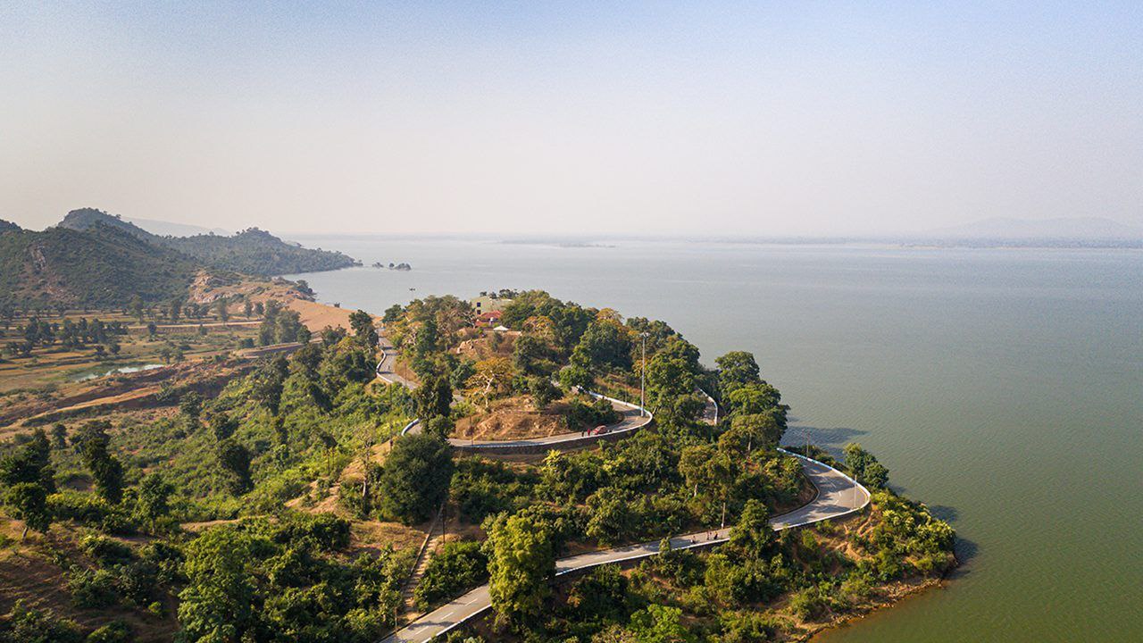
ý§ìý§°ý§øý§∂ý§æ: ý§∞ý§æý§úý•çý§Ø ý§ïý§æ ý§µý§øý§µý§∞ý§£ ý§ìý§°ý§øý§∂ý§æ, ý§≠ý§æý§∞ý§§ ý§ïý•á ý§™ý•Çý§∞ý•çý§µý•Ä ý§§ý§ü ý§™ý§∞ ý§∏ý•çý§•ý§øý§§ ý§èý§ï ý§∞ý§æý§úý•çý§Ø ý§πý•à, ý§úý•ã ý§Öý§™ý§®ý•Ä ý§∏ý§Æý•Éý§¶ý•çý§ß ý§µý§øý§∞ý§æý§∏ý§§, ý§∏ý§Çý§∏ý•çý§ïý•Éý§§ý§ø ý§îý§∞ ý§™ý•çý§∞ý§æý§ïý•Éý§§ý§øý§ï ý§∏ý•åý§Çý§¶ý§∞ý•çý§Ø ý§ïý•á ý§≤ý§øý§è ý§™ý•çý§∞ý§∏ý§øý§¶ý•çý§ß ý§πý•àý•§ | ý§µý§øý§µý§∞ý§£ (Detail) | ý§úý§æý§®ý§ïý§æý§∞ý•Ä (Information) | |---|---| | ý§∏ý•çý§•ý§æý§™ý§®ý§æ ý§µý§∞ý•çý§∑ (Establishment Y...Read More

Odisha: State Overview Odisha, located on the eastern coast of India, is a state rich in history, culture, and natural beauty. | Detail | Information | |---|---| | Establishment Year | April 1, 1936, as the first Indian state (pre-independence) constituted on a linguistic basis. This day is celebrated as Utkala Dibasa (Odisha Day). | | Borders | Bounded by Jharkhand and West Bengal to the north and northeast, the Bay of Bengal to the east, and Andhra Pradesh and Telangana to the south and C...Read More
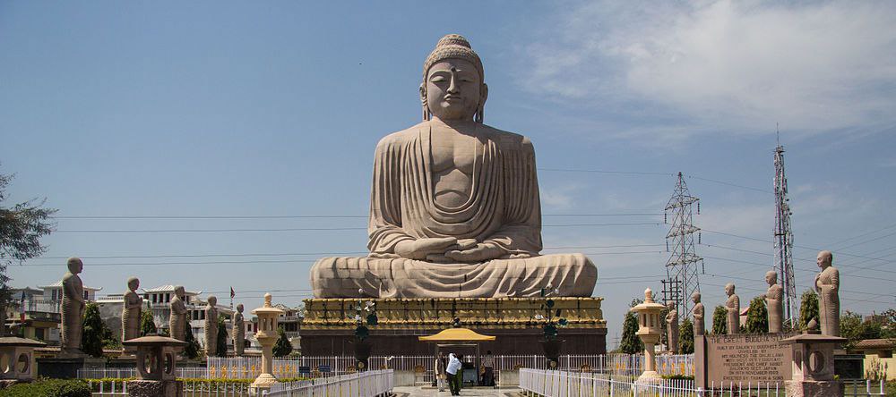
ý§ùý§æý§∞ý§ñý§Çý§° ý§ïý§æ ý§Öý§∞ý•çý§• ý§πý•à 'ý§úý§Çý§óý§≤ý•ãý§Ç ý§ïý•Ä ý§≠ý•Çý§Æý§ø'ý•§ ý§Øý§π ý§™ý•Çý§∞ý•çý§µý•Ä ý§≠ý§æý§∞ý§§ ý§ïý§æ ý§èý§ï ý§∞ý§æý§úý•çý§Ø ý§πý•à ý§úý•ã ý§ñý§®ý§øý§ú ý§îý§∞ ý§úý§®ý§úý§æý§§ý•Äý§Ø ý§∏ý§Çý§∏ý•çý§ïý•Éý§§ý§ø ý§∏ý•á ý§∏ý§Æý•Éý§¶ý•çý§ß ý§πý•àý•§ ¬Ý ¬Ý ý§∏ý•çý§•ý§æý§™ý§®ý§æ ý§îý§∞ ý§∏ý•Äý§Æý§æý§èý§Å (Borders) ¬Ý* ý§∏ý•çý§•ý§æý§™ý§®ý§æ ý§µý§∞ý•çý§∑: ý§ùý§æý§∞ý§ñý§Çý§° ý§ïý•ã ý§Üý§ßý§øý§ïý§æý§∞ý§øý§ï ý§§ý•åý§∞ ý§™ý§∞ 15 ý§®ý§µý§Çý§¨ý§∞, 2000 ý§ïý•ã ý§¨ý§øý§πý...Read More

Jharkhand, meaning 'The land of forest,' is an eastern Indian state rich in minerals and tribal culture. ¬Ý ¬Ý Establishment and Borders ¬Ý* Establishment Year: Jharkhand was officially established on November 15, 2000, carved out of the southern part of Bihar. This date is also the birth anniversary of the tribal leader Birsa Munda. ¬Ý* Borders: The state shares its borders with five Indian states: ¬Ý ¬Ý* North: Bihar ¬Ý ¬Ý* Northwest: Uttar Pradesh ¬Ý ¬Ý* West: Chhattisgarh ¬Ý ¬...Read More
ý§∏ý•çý§•ý§æý§™ý§®ý§æ ý§îý§∞ ý§∏ý•Äý§Æý§æý§èý§Å | ý§µý§øý§∂ý•áý§∑ý§§ý§æ | ý§µý§øý§µý§∞ý§£ | |---|---| | ý§∞ý§æý§úý•çý§Ø ý§ïý•Ä ý§∏ý•çý§•ý§æý§™ý§®ý§æ ý§ïý§æ ý§µý§∞ý•çý§∑ (ý§¨ý§øý§πý§æý§∞ ý§™ý•çý§∞ý§æý§Çý§§) | 22 ý§Æý§æý§∞ý•çý§ö, 1912, ý§úý§¨ ý§áý§∏ý•á ý§¨ý•çý§∞ý§øý§üý§øý§∂ ý§∞ý§æý§ú ý§Æý•áý§Ç ý§¨ý§Çý§óý§æý§≤ ý§™ý•çý§∞ý•áý§∏ý•Äý§°ý•áý§Çý§∏ý•Ä ý§∏ý•á ý§Öý§≤ý§ó ý§ïý§∞ý§ïý•á ý§¨ý§®ý§æý§Øý§æ ý§óý§Øý§æ ý§•ý§æý•§ ý§áý§∏ ý§§ý§æý§∞ý•Äý§ñ ý§ïý•ã ý§¨ý§øý§πý§æý§∞ ý§¶ý§øý§µý§∏ ý§ïý•á ý§∞ý•Çý§™ ý§Æý•áý§Ç ý§...Read More

Establishment and Borders | Feature | Detail | |---|---| | Establishment Year (Bihar Province) | March 22, 1912, when it was carved out of the Bengal Presidency by the British. This date is celebrated as Bihar Diwas. | | Current State Formation | The modern state of Bihar came into existence on November 15, 2000, when its southern part was separated to form the new state of Jharkhand. | | Borders | North: Nepal (an international border) East: West Bengal West: Uttar Pradesh South: Jharkhand...Read More